Date of preparation: 2012
Project scale: 790,000 m2
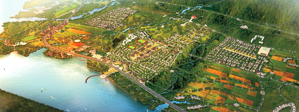
This project is located at the central position of Yantai Eco & Tech Development Zone and junction of Bajiao Plot and Guxian Plot. Baiyin River falls within a seasonal river. The upstream is mountainous land. The river flows into the Yellow Sea through the development zone.
The scope of design is started from the belt expressway in the west to the Yellow Sea in the east, with a length of about 5.3Km and width about 60 – 204m, with total area about 79ha, including land area about 38ha and water area about 41ha.
(I) Theme
Silver chain connected with Green Mountain and sea
Bent Baiyin River flows into the east sea, flowing water emerges silver; Green trees and fresh flowers beatify the both banks while the silver chain landscape beautifies the new city. A safe, clear, natural and fresh ecological river flows in the city as if a quiet, silent, comfortable and beautiful landscape picture scroll is embedded in the city.
(II) Objective:
1. Building a safe and applicable urban ecological river
2. Creating a urban green protective corridor with rich layers
3. Creating a unique riverside characteristic landscape belt
4. Creating a lifeful urban recreational belt


|